2. The Scottish context
Scotland has the oldest land registry in the world – The General Register of Sasine’s – in which the Registration Act 1617 of the old Parliament of Scotland, introduced a description-based account of landownership in Scotland. The first entry in this register was in 1617.
Later, the Land Registers (Scotland) Act 1868 modernised the system and shortly afterwards (1871-1905) search sheets were introduced which showed the history of transactions for any given property. In 1948 Registers of Scotland (a public body) was established, who hold responsibility of maintaining and improving the land register to the present day.
The Land Registration (Scotland) Act 1979 created the first map-based register in Scotland – what could be considered a very limited form of cadastre. Digitising this register began shortly after in 1981.
The Land Registration etc. (Scotland) Act 2012 introduced electronic documents, signatures and registration, and remains the most recent relevant Act.
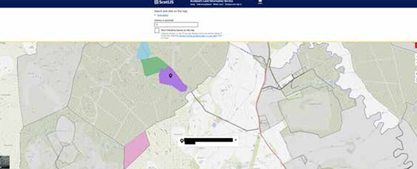
In 2018, ScotLIS was introduced which can be considered a Land Information System that combines the cadastre, the land registry and other elements including Ordnance Survey data and satellite imagery (see Box 1 below).
During the Covid-19 pandemic in 2020 RoS made the decision to accept digital copies of scanned documents (and later made it the default approach) through a Digital Submission Service.7 Registers of Scotland also keep an additional 23 registers which were introduced as part of their statutory duties; these include the Register of Community Interests in Land (introduced through the Land Reform (Scotland) Act 2003), the Register of Persons Holding a Controlled Interest in Land (introduced though the Land Reform (Scotland) Act 2016) and the map-based Crofting Register (introduced by the Crofting Reform (Scotland) Act 2010).8
To this day, some properties remain on the Register of Sasines, as the ‘trigger point’ for moving on to the new register is a transaction transferring the property.9 Work has been ongoing (since the mid-1990s) to add the historical Register of Sasines to a modern spatial cadastral system. Recently, the ‘Indicative Sasines’ dataset was released which is the first time the Register of Sasines has been produced spatially.10
The Land Register is still incomplete. Approximately 59.8% of land in Scotland is now on the Land Register, roughly 4.6% is being processed, leaving roughly 31.6% remaining in the Register of Sasines.11
Scotland has an ongoing Land Reform policy programme which has the aims of reducing concentration of landownership and increasing both the diversity and transparency of landownership. A complete cadastral system (i.e. all land parcels in Scotland are included on the cadastre, and both modern and Sasines registers are included) could help alleviate some issues around transparency of ownership.12 The recent Land Reform (Scotland) Act 2025 introduced compulsory Land Management Plans for landholdings of over 1000ha, which could be incorporated and validated through a cadastral system. It could also allow for more informed decisions to be made around potential future taxation and land valuations.
The primary function of the land register and cadastre is to provide legal certainty of ownership, and the coverage is national (although coverage is incomplete), including the territorial seabed 12 nautical miles from shore and other land covered by water.